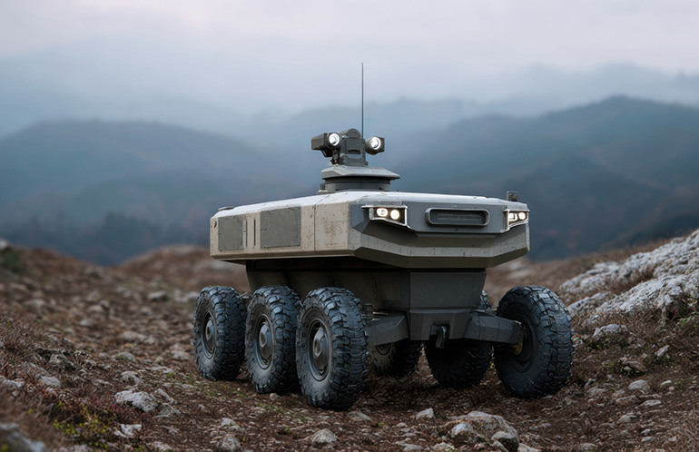
In the field of autonomous navigation, sight is often a liar. A patch of broken ground can appear stable to a high-resolution camera or a Lidar scanner, masking the reality of loose scree or a hollow pocket of soil. For uncrewed ground vehicles (UGVs), this discrepancy between visual data and physical reality leads to a common, costly failure: the tip-over. Even when the navigation stack flags a path as "safe," a robot may find itself losing purchase on a surface that behaves more like powder than stone under the weight of its chassis.
The limitation lies in the current reliance on external perception. Systems like SLAM (Simultaneous Localization and Mapping) — the algorithmic backbone that allows a robot to build a spatial model of its environment while tracking its own position within it — are exceptional at constructing geometric representations of the world. They lack, however, an understanding of structural integrity. They see the shape of a rock but not how it will shift under load. When a robot hesitates on an incline, it is often because its internal sensors are detecting a physical reality that its cameras cannot see. Yet without a formal framework to process these vibrations, the machine has no way to act on that information until it is too late.
From seeing to feeling
To bridge this gap, engineers are turning to vibration monitoring as a critical secondary layer of intelligence. The concept borrows from a well-established discipline in industrial engineering: condition monitoring, where accelerometers and frequency analysis have long been used to detect faults in rotating machinery, bridges, and building foundations before they become visible. Applied to mobile robotics, the same principle allows a UGV to "listen" to the frequency and intensity of its own movements as it traverses terrain.
This haptic feedback — derived from onboard inertial measurement units (IMUs) and accelerometers rather than external cameras or laser scanners — enables the robot to distinguish between compact earth and deceptive dust in real time. A surface that looks uniform to a depth camera may produce a telltale vibration signature when a wheel or track passes over it: higher-frequency oscillations for loose gravel, dampened low-frequency responses for saturated clay, sharp transients for fractured rock concealing voids beneath. By classifying these signatures against a learned library of terrain responses, the system can adjust the robot's center of gravity, reduce speed, or reroute its path before a tipping threshold is reached.
The approach represents a shift from purely geometric mapping to a more embodied form of machine intelligence, one in which the robot's understanding of the world is as much about touch as it is about sight. In biological terms, the analogy is proprioception — the internal sense that allows an animal to know where its limbs are and how the ground is responding to its weight, independent of vision.
The harder integration problem
The technical challenge is not merely in collecting vibration data but in fusing it meaningfully with existing navigation stacks. SLAM pipelines are optimized for geometric consistency; injecting a noisy, high-frequency signal about terrain compliance into that loop without degrading localization accuracy is a non-trivial software architecture problem. Latency matters: if the vibration signal takes even a fraction of a second too long to propagate into the path planner, the robot may already be committed to a maneuver it cannot safely complete.
There is also the question of generalization. A vibration model trained on the dry, rocky terrain of a mining site may perform poorly in the muddy conditions of an agricultural field or the sandy substrate of a coastal survey. Building terrain libraries that are broad enough to be useful yet specific enough to be reliable remains an open research problem, one that echoes the broader challenge of sim-to-real transfer across robotics.
The stakes extend beyond academic interest. UGVs are increasingly deployed in disaster response, military logistics, planetary exploration, and infrastructure inspection — environments where a single tip-over can mean a lost asset with no possibility of human retrieval. For these applications, the margin between a successful traverse and a mission-ending failure often comes down to information the camera never had.
What vibration monitoring offers is not a replacement for vision-based navigation but a complementary sense — one that closes the loop between what the world looks like and how it actually behaves. Whether that sense can be made robust and general enough to become standard equipment, rather than a research curiosity, depends on how effectively the robotics community solves the fusion and generalization problems that sit between a promising signal and a reliable system.
With reporting from The Robot Report.
Source · The Robot Report